Explore More of the Central Queensland Highlands’ fascinating – and oftentimes tragic – story through the region’s memorials, monuments and markers.
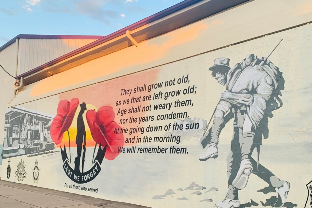
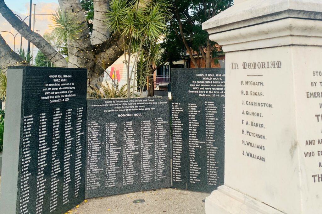
Emerald’s commemorative war mural was unveiled in 2022 to honour local returned service men and women. Painted across the Anakie Street side of the Emerald Town Hall, the striking artwork captures the ANZAC spirit, featuring poppies and the Ode of Remembrance, and pays tribute to all Australians who have served their country. The artwork was completed by talented CQ artists Bill and Luke Gannon, and was paid for by Central Highlands Regional Council in support of the Emerald RSL.
The town’s cenotaph and honour roll are nearby.
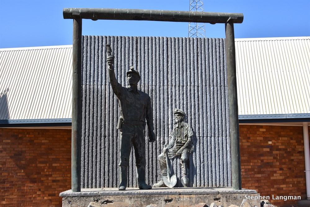
Blackwater Miner’s Memorial Located in front of the ambulance station on Mackenzie Street is a memorial entitled ‘At the Coal Face’, erected by the late Blackwater Mine Workers Memorial Trust and dedicated to the memory of those whose lives it claimed. The memorial also pays tribute to the important role the coal industry has played in the development of the region.
It was sculpted by renowned sculptor Anton Bruinsma and was opened on 3rd December 1988.
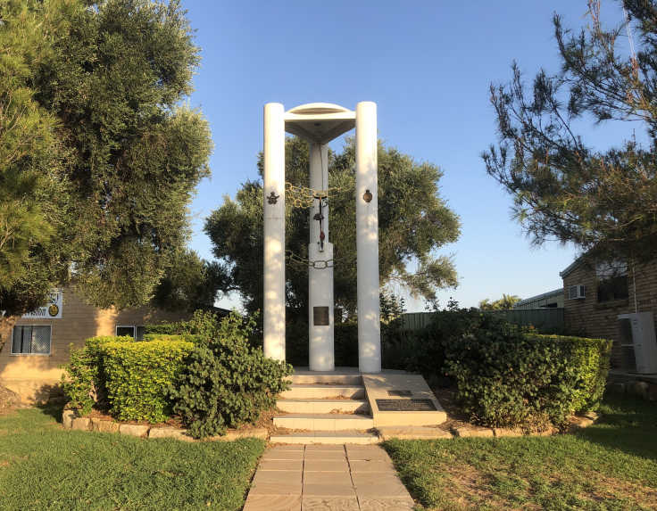
Blackwater War Memorial Two pine trees grown from seeds taken from the Gallipoli peninsula in Turkey are the highlight of the town’s war memorial in Arthur Street. The memorial itself consists of three white columns with top plinth. There is a central column that supports an up-turned rifle and helmet, signifying the battlefield grave of a dead serviceman. The memorial displays badges of the Armed Forces and all columns are symbolically linked by chains.
The rocks surrounding the memorial were gathered from a World War 2 training area near Blackwater, adding military significance to the memorial, and the sandstone was from the Walton Creek area near Bluff. It is believed the sandstone was originally part of a bridge built by convicts.
The memorial was erected by the Ladies Auxiliary and the Blackwater RSL, and unveiled on 26 January 1985. A local Vietnam Veteran, the late Neville Tickner, was the driving force behind fundraising efforts for this and the Miner’s Memorial.
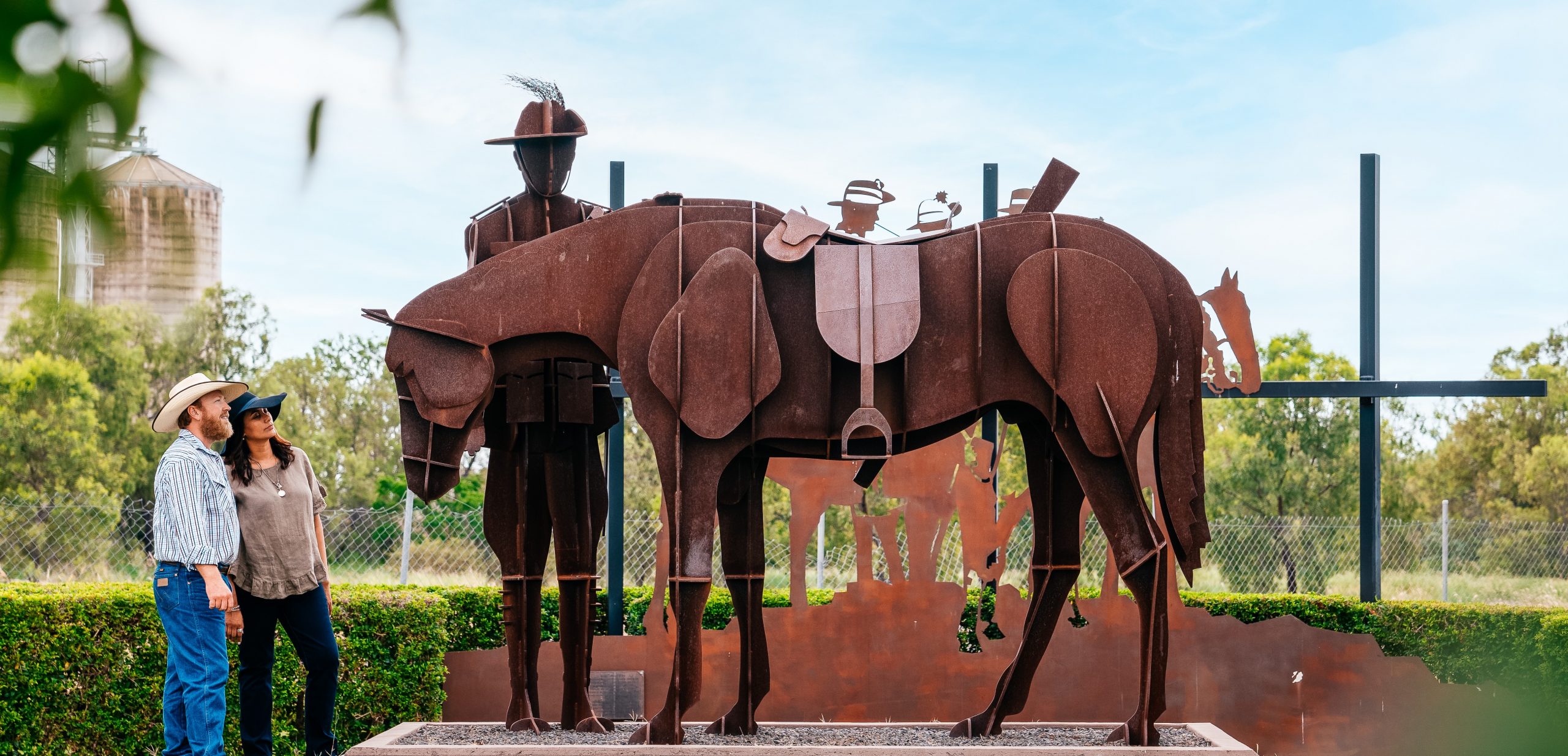
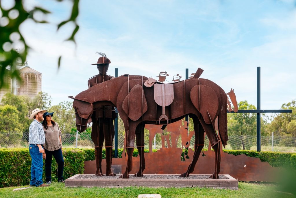
Australian Light Horse Monument, Capella According to local lore, the first time Australian troopers wore the now famous emu feathers in their slouch hats was at Peak Downs station during the Great Shearers’ Strike of 1891. The locally constructed monument in the Capella Parklands is a striking dedication to the area’s contribution to the history and tradition of Australian armed forces.
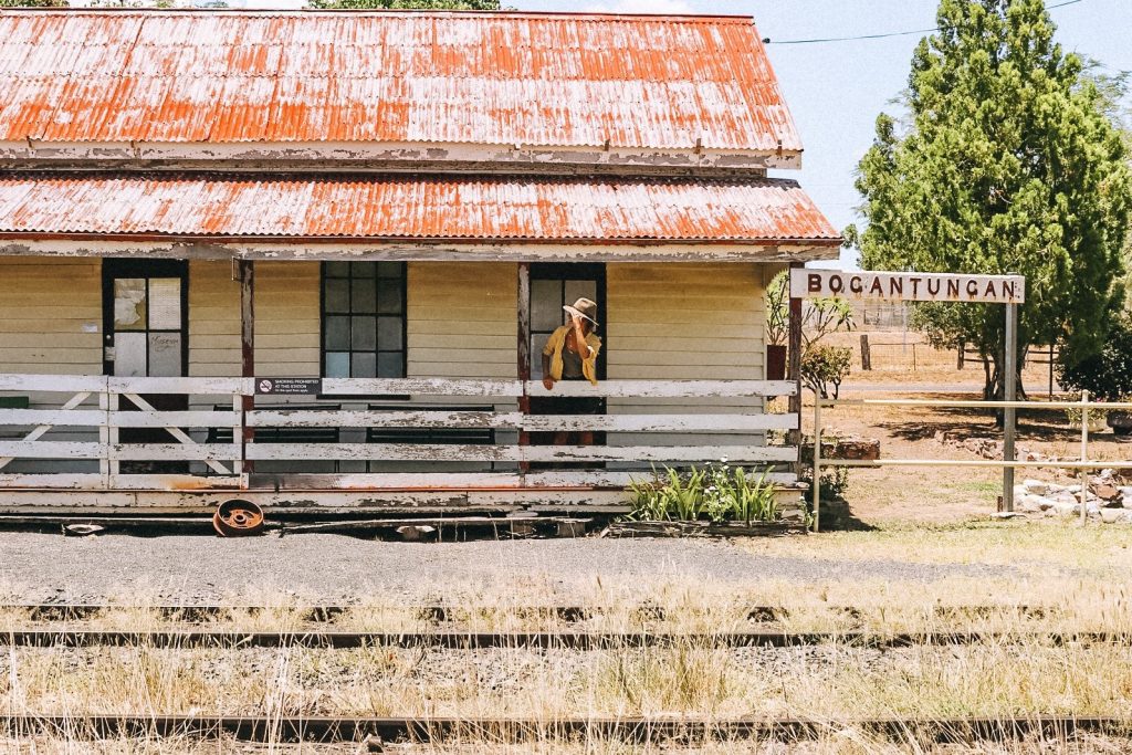
The Bogantungan Historical Railway includes a memorial and display of memorabilia of the Midlander rail disaster, a permanent reminder of the seven lives lost and those who risked their lives to rescue the injured.
At 2.30 am on 26 February 1960, the Midlander passenger train, heading east to Rockhampton, had passed over the flooded Medway Creek, just west of the town. The bridge collapsed when the train was partly over, and a number of carriages dropped into the water. Sadly, four passengers and three crew were killed, and 43 people were injured.
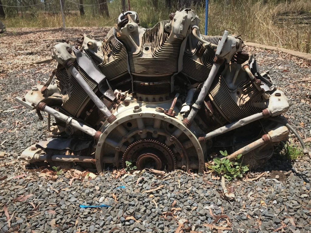
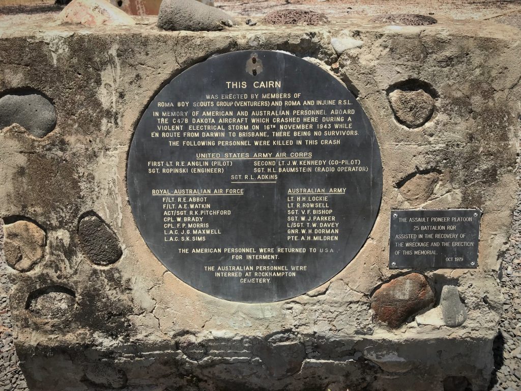
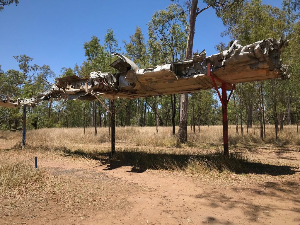
The Dakota C-47 Air Crash Memorial commemorates 14 Australian soldiers and five US military personnel killed when their aircraft went down during a violent storm. The catastrophic plane crash occurred near Rolleston on November 16, 1943, during World War 2.
The memorial includes two engines from the plane, part of the wings and some of the undercarriage.
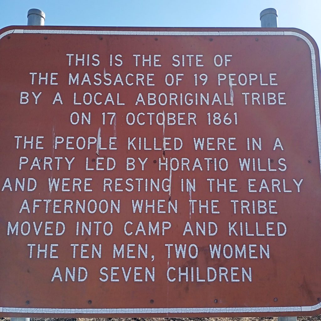
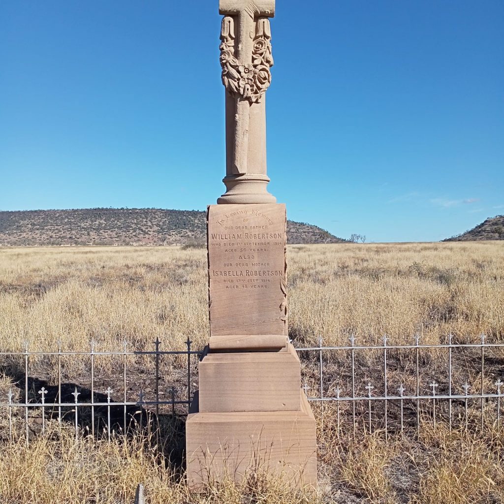
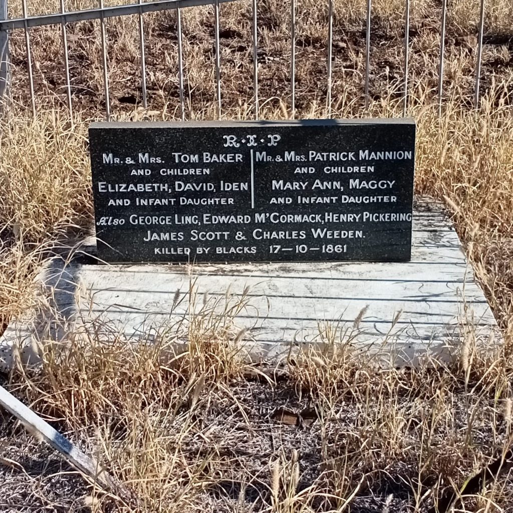
Wills Massacre Site A memorial headstone can be viewed at the site of the 1861 frontier conflict, north of Springsure, in which 19 Europeans were killed by Aboriginal people from the Kairi tribe on Cullin-la-ringo Station.
It was a retaliatory massacre, part of the savage frontier guerrilla war that was being waged at the time. Some local graziers had been poisoning Kairi Kairi water holes and shooting Aboriginal people, while the Native Mounted Police were being encouraged to forcibly evict Aboriginal people from station and river camps.
This was the largest recorded massacre of Europeans in Australian history.
Google Maps location. To find this site, from Springsure, follow the Dawson Developmental Road for about 12km, turn right onto Birtley Road and travel for 21km, turn left onto Garden Creek Road and follow for about 1.5km to reach a sign-posted car park. Walk through the turnstile and follow the signed footpath for about 700 metres.
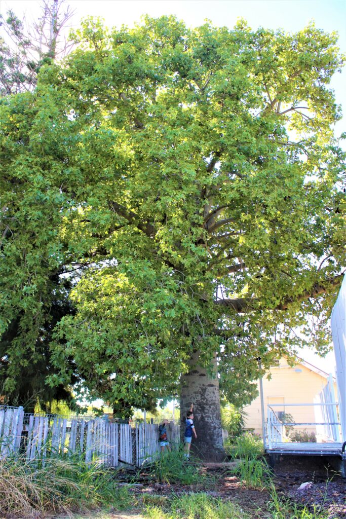
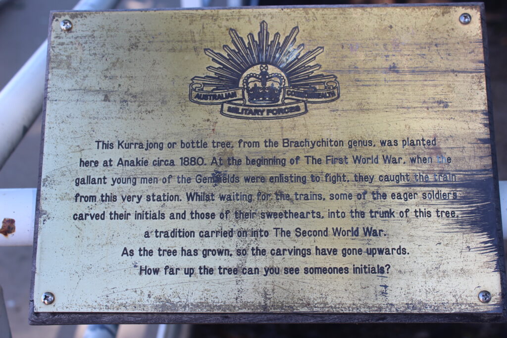
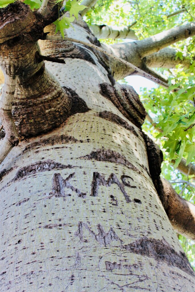
Anakie Bottle Tree, located at the township’s railway station, is estimated to be more than 140 years old and still bears the initials of World War 1 and 2 soldiers and their sweethearts. The young men carved letters into the trunk while waiting to catch the train to enlist. Many of those young men never made it home. You’ll need to look up a fair way to see the initials because the tree has grown!
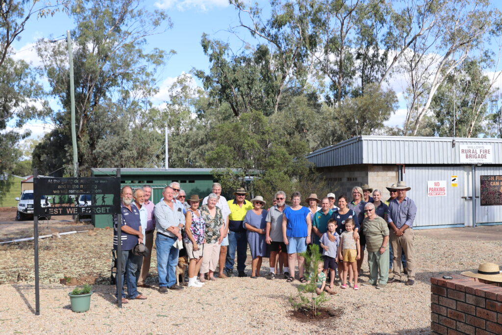
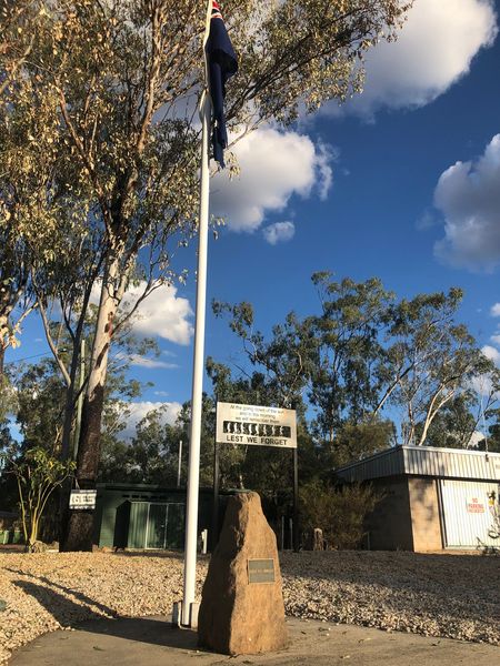
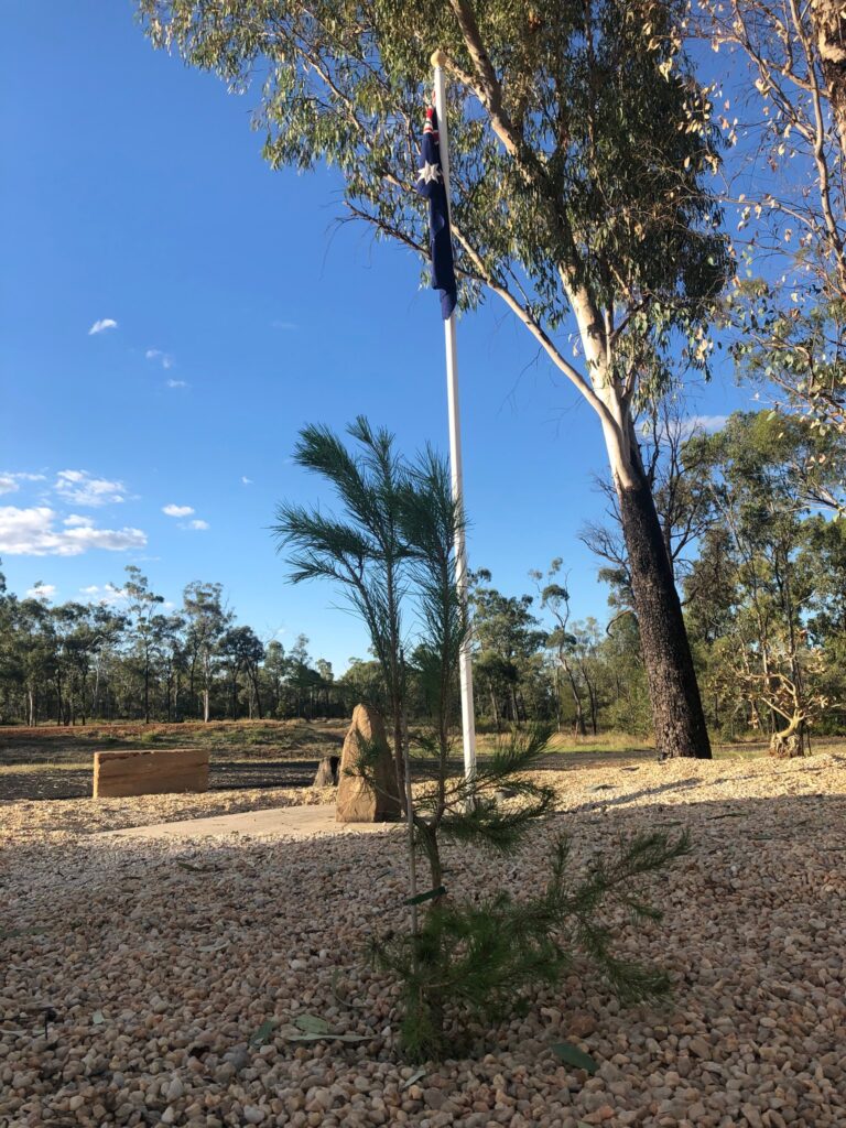
Willows, a small town on the Sapphire Gemfields, unveiled its upgraded ANZAC memorial in April 2022. The site includes a lone pine tree, symbolic of the solitary tree on Gallipoli Peninsula, and a framed ‘Lest We Forget’ sign. Read more about the upgrade.
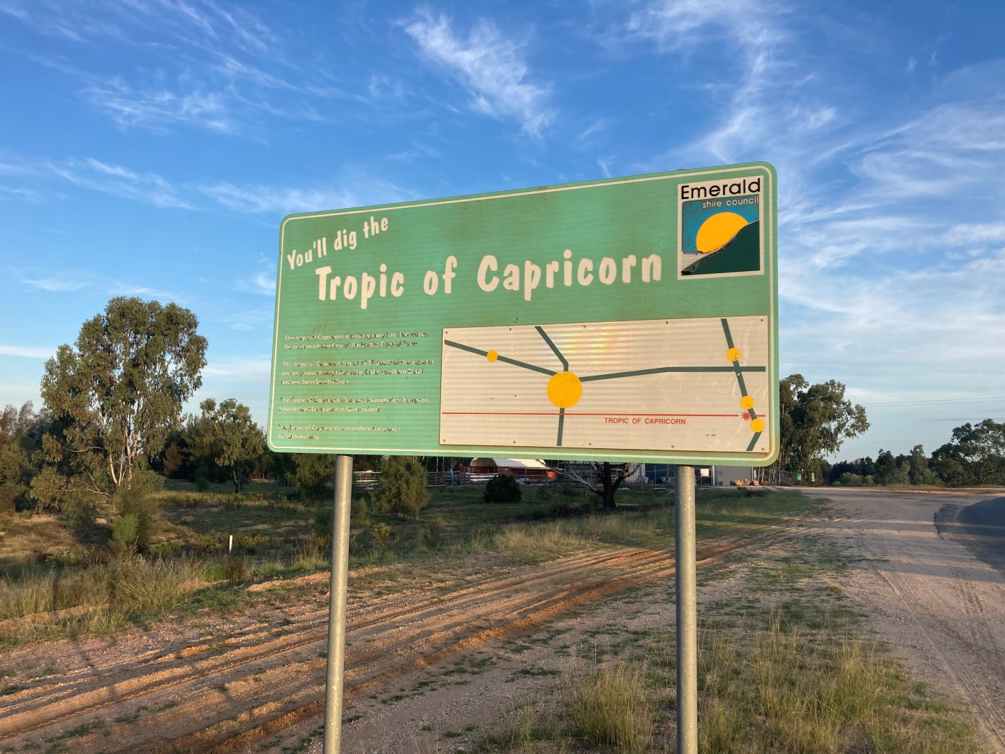
Cutting through the Central Queensland Highlands is the Tropic of Capricorn, one of the five major circles of latitude marked on maps of Earth. There signs at Emerald and the Sapphire Gemfields that mark its location but keep in mind they are looking rather tired (we’re working on replacements)!
Sapphire Gemfields Google Maps location